Hawkesbury Post contacted all...
Hawkesbury Post contacted all...

In a heartwarming recognition of community...

After more than two decades of dedicated service, the...
When the first of a series of major floods hit the Hawkesbury in February 2020, Warragamba Dam was less than half full. Had the dam been at full capacity, the flood at Windsor would have been three metres higher.
This finding is part of a landmark flood study released 21 June, 2024. The study provides the most comprehensive analysis of flooding in the Hawkesbury-Nepean Valley and, for the first time, analyses the impact of climate change on flooding in the valley.
The seriousness of flooding in the Hawkesbury-Nepean Valley has been known for decades. Now, new data and scientific analysis in the “2024 Hawkesbury-Nepean River Flood Study” underscore the gravity and danger of these floods. The study, commissioned by the NSW Government, spans the entire 21,400 km² catchment area and is backed by two independent reviews. Using advanced technology, it models water movement through the valley, incorporating data on flood levels, depth, and velocity to enhance understanding of flood risk. Over 20,000 scenarios were analysed, contextualising recent flood events.
The study leaves no doubt as to the most significant influence on flooding in the floodplain: Warragamba Dam. “The catchment above Warragamba Dam makes up around 80% of the total catchment to Penrith and 70% to Windsor. Therefore, it has a major influence on flooding in the valley, contributing the majority of flows during the largest floods,” the study found.
This was particularly evident in February 2020. “The dam was only at 43% capacity at the start of the February 2020 flood and captured all the inflows to the dam. Modelling shows that if the dam had been full, flood heights at Windsor would have been around three metres higher,” the study found. “However, history shows that most large floods occur during wet periods when the dam is nearly full. When this happens, the dam cannot hold back inflows. The floods in 2021 and 2022 are recent examples of this,” the report said.
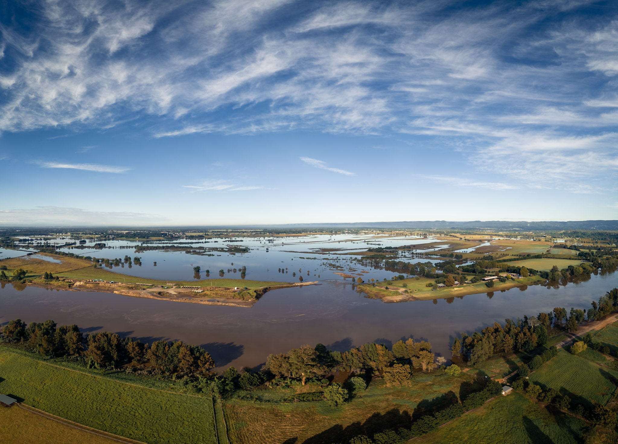
A photo that shows the catastrophic damage cause by successive flood. The collapsed river levee at Cornwallis.
Key findings emphasise the complexity and high risk of flooding in the Hawkesbury-Nepean floodplain. The valley’s geography creates natural chokepoints, leading to rapid, deep, and widespread flooding. Four distinct floodplains are identified: Wallacia, Penrith/Emu Plains, Richmond/Windsor, and Lower Hawkesbury.
The study warns that climate change is expected to increase flooding in the Hawkesbury-Nepean Valley. “The unique topography of the Hawkesbury-Nepean Valley means that impacts of increased rainfall intensity are larger than in many other NSW catchments. At Windsor, the 1-in-100-year flood height would increase by 0.9 metres with a 9.5% increase in rainfall intensity.”
The study also notes that the flood history of the valley suggests periods of higher floods that last for decades, followed by similar periods of fewer and smaller floods. This pattern is flood-dominated and drought-dominated, influenced by the El Niño Southern Oscillation (ENSO) climate driver. “It’s too early to know whether the cluster of floods from 2020 to 2022 signals the start of a new flood-dominated period,” the study said.
While the NSW government is investigating reducing the full supply level of Warragamba Dam permanently to 80%, this may take many years to implement. In the meantime, residents and experts are calling for laws to allow water to be released from the dam ahead of major rain events to reduce downstream flooding impacts. With the likelihood of a La Niña event forming this winter, residents are increasingly anxious about the risk of another major flood this winter or spring.
In an extremely rare Probable Maximum Flood (PMF) event, estimated at over 13 metres higher than the 1-in-100-year flood level, no land would be above floodwater between North Richmond and Oakville.
The study has drawn criticism for not measuring overland flooding, which often compromises evacuation routes and determines whether homes flood or not. The study stated that future development in the catchment would only have a small impact on Hawkesbury-Nepean flooding due to the South Creek catchment making up only 5% of the total catchment area to Windsor. The bulk of the floodwaters to Windsor come from the Warragamba catchment, followed by the Nepean.
The study will provide data to support the first Regional Disaster Adaptation Plan being developed by the NSW Reconstruction Authority, focusing on the Hawkesbury-Nepean Valley. It will inform a suite of risk reduction measures as guided by that plan.
Read more here : Hawkesbury-Nepean River Flood Study 2024 – Flood Projects – NSW Flood Data Portal

The recent unconventional emoji poll conducted...

Western Sydney University student Jasmine Haydon...
Hawkesbury Post contacted all candidates with...

By Imy Abbott For the past four years, Charlene...

829 Upper Colo Road, Colo Perfectly...

11 Terrain Road, North Richmond Welcome to 11...
259 Pitt Town Bottoms Road, Pitt Town Bottoms...

53 Hawkesbury Street, Pitt Town Hamish Rogers...
Western Sydney University student Jasmine Haydon...

As the epicentre of equestrian sports in...

The Hawkesbury's own Courtney Nevin is set to...

At just 16 years old, Mikaela Shedden has...

Huge crowds descended on Clarendon Showgrounds...

by Imogen Abbott Fantasia Showstoppers is...
On Sunday 2 June, Kurrajong Heights Bowling Club...

New Haven Farm Home is a local...