Hawkesbury Post contacted all...


Hawkesbury Post contacted all...

In a heartwarming recognition of community...

After more than two decades of dedicated service, the...
Four years worth of vital wildlife rescue data that helps to guide property development approvals, including in the Hawkesbury, is missing from a New South Wales native animal tracking database. The data gap has left hundreds of rescues of threatened endangered species, including koalas, unrecorded across the state.
WIRES, a prominent wildlife rescue group, has described this data gap as a “gift” to developers, attributing it to the long-standing under-resourcing of the BioNet database by the previous state government.
This information vacuum empowers property developers to obtain approvals for development projects based on inaccurate evidence of endangered species inhabiting the sites in question, environmental groups said. Once approved the development approvals can’t be revoked.
The discovery comes as environmental groups and concerned residents are calling for Hawkesbury City Council (HCC) to halt the clearance of critical koala habitat. HCC was the only peri-urban council to controversially adopt the Rural Boundary Clearing Code, passed in 2022, which enables unchecked clearing of existing koala habitat.
“We are in a war and we are losing it and we are losing it badly….. And the war is the rapid development that’s seeing koala habitat cut down,” WIRES koala rescuer Morgan Philpott told the Hawkesbury Post.
The discovery of the missing data was made by the Sydney Koala Basin Network (SBKN). It estimates that approximately 400,000 rescue records are unaccounted for, including those of 28,000 threatened animals.
In the Hawkesbury region alone, 4,000 wildlife rescue records are absent from BioNet, involving around 250 rescues of threatened species, including 100 koalas. This list encompasses creatures such as Gang Gang Cockatoos, Regent Honeyeaters, Powerful Owls, Grey-Headed Flying Foxes, Squirrel Gliders, Spotted-Tail Quolls, and, most notably, koalas.
“Wildlife rescue data is incredibly important as rescues predominantly occur in non-protected areas where wildlife are facing threats. With koalas, a lack of habitat forces them to cross roads, and a lack of habitat connectivity means they are exposed to attacks by dogs. All this stress also leads to disease,” Stephanie Carrick from the Sydney Koala Basin Network said.
“Without these records being in BioNet, it is not possible to properly assess the full and potential impact of land-clearing and development in sensitive areas,” she said.
Philpott said the collected data was critical to enable informed decision making about future developments in areas crucial to koala survival.
The missing data raises new questions about previously approved developments which relied upon the inaccurate and misleading BioNet data. A recently approved development at Kurrajong – known as the “Bark Park”, relied partly on the inaccurate BioNet data as part of its Koala Assessment Report, a prerequisite for its Development Application. It concluded that the site is “highly unlikely to support the koala for breeding or foraging purposes.” But Philpott disagrees saying the site was very likely to have supported koalas.
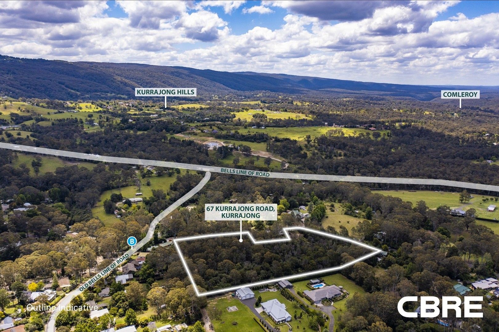
Koalas have also been sighted on a bush block slated for a 37 lot development on Kurrajong Road, Kurrajong. The Land and Environment Court (LEC) controversially approved the PRJM Pty Ltd development despite significant community and council objections. Residents say in the past five years – since the LEC ruling – there have been an increasing number of koala sightings on the 8 acre block as they search for habitat lost in surrounding areas.

The site has been the subject of koala sightings since it won court approval for a 37 lot development.
“I am very unhappy about the fact that this very important data around threatened species is not being entered,” NSW Environment Minister Penny Sharpe said.
“I was surprised and shocked to learn about it and I’ve asked my department for immediate information about how we’re going to upgrade this.It’s fundamental to the planning system and it’s fundamental to how we manage threatened species in this state.”