Stylecraft & Co., approaching...

 (2000 × 75 px) (2000 x 60 px)")
Stylecraft & Co., approaching...
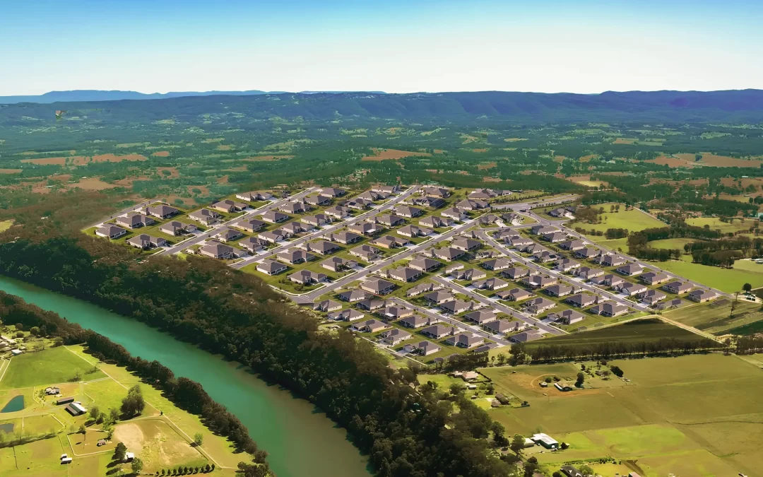
An unprecedented surge in development west of...
Hawkesbury City Council has stated it is not responsible...

Windsor Bridge this morning at 6.15am, still open – picture by Paul Caleo
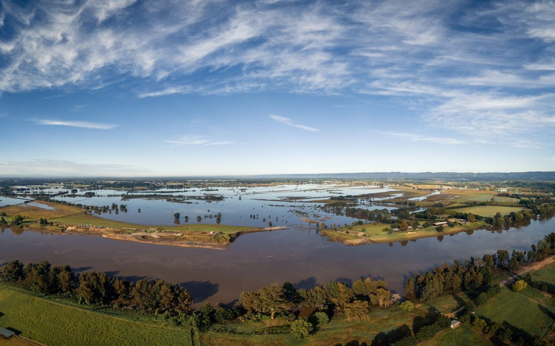
Rivers rose very swiftly last night, seeing North Richmond Bridge go under just before 1am and Yarramundi was closed by 7am. This morning Windsor Bridge is still open and traffic flowing.
This morning at 6.15am, Windsor Bridge gauge showed the river still climbing but just above moderate flood level.
Will Windsor Bridge be closed? That’s the big one this morning.
The river is rising slower than it did overnight but BOM are saying “significant flows” are still coming down the Upper Nepean system.
Really, the big issue is whether the roads will flood at the Freemans Reach/Wilberforce end, so making it impossible to get on Windsor Bridge. We’ll just have to wait and see what happens, but BOM are saying the river at Windsor should peak at 9.80m by this evening – Friday – and the bridge height is 9.4m so it could well close later today.
The Bureau of Meteorology says “significant flows” are still coming down from the Upper Nepean.

North Richmond Bridge – yes, it’s under there – this morning at 6.40am – thanks to Janine Drury for the picture
However, according to BOM’s latest update – issued at 5.37am Flood Warning 12 – the river levels are mostly expected to be below the March flood, so some good news there.
Areas included parts of North Richmond, particularly Terrace Road, Cornwallis and eastern part of Richmond Lowlands, low lying parts of Agnes Banks, parts of Cattai, including Riverside Caravan Park, parts of Ebenezer, including Port Erringhi Road, Sirius Crescent, and Shallow Reach Place, parts of Pitt Town, including Percy’s Place Caravan Park, parts of Sackville North, including Mud Island Road and Pages Wharf Road, and Pitt Town Bottoms.
Here’s BOM’s detailed assessment this morning so far:
Hawkesbury River
The Hawkesbury River at North Richmond (WPS) is likely to exceed the major flood level (10.50 m) around 10:00 am Friday and may reach around 11.80 metres midday Friday with major flooding, a little below the Feb 2020 flood level.
The Hawkesbury River at Windsor (WPS) may reach around 9.80 metres overnight Friday into Saturday with moderate flooding.
The Hawkesbury River at Sackville is expected to exceed the minor flood level (4.60 m) around 9:00 am Friday morning. The river level may reach around 5.80 metres Friday evening with minor flooding.
Colo River
Minor flooding is occurring along the Colo River at Putty Road.
The Colo River at Putty Road may reach around 3.6 metres 09:00 am Friday with minor flooding.
A major flood peak is expected along the Upper Nepean River at Wallacia early Friday morning with river levels higher than March 2022 expected.
Warragamba dam is spilling. Major flooding is likely along the Hawkesbury River at North Richmond from Friday morning as a result of significant flows from the Upper Nepean.
Moderate flooding is expected at Windsor during Friday. River level rises have been observed along the Upper Colo River, and minor flooding is possible at Putty Road Friday morning.
Predictions for Lower Portland and Wisemans Ferry will be provided after upstream peaks are observed.
Whilst further showers are forecast for Friday and Saturday they are not expected to produce renewed river level rises.
A Flood Watch is current for the Upper Coxs and Macdonald Rivers.
Upper Nepean River
Major flooding is occurring along the Upper Nepean River at Menangle. Moderate flooding is occurring at Camden and Wallacia. Major flooding is expected at Wallacia.
The Nepean River at Menangle Bridge peaked at 16.83 metres around 04:00 pm Thursday 07 April, higher than the March 2022 flood peak (15.92 m) and slightly higher than the April 1988 flood peak (16.75 m). The Nepean River at Menangle Bridge is currently at 12.42 metres and falling with major flooding.
The Nepean River at Camden Weir peaked at 12.21 metres round 10:00 pm Thursday 07 April, slightly higher than the March 2022 flood level. The Nepean River at Camden Weir is currently at 11.43 metres and falling with moderate flooding.
The Nepean River at Wallacia Weir is likely to exceed the major flood level (11.00 m) around 07:00 am Friday and may reach around 12.90 metres around 11:00 am Friday, higher than the river levels in the March 2022 floods, but not as high as the river levels in the April 1988 floods.
The Nepean River at Penrith may peak near 6.00 metres around 07:00 am Friday with minor flooding.
If you are already a Hawkesbury Post supporter, thank you! Our site is free, relying on our supporters to operate. Independent journalism is more important than ever, please consider contributing.
Don’t pay so you can read it. Pay so everybody can read it!
Stylecraft & Co., approaching its...

The Hawkesbury's own Courtney Nevin is set to...

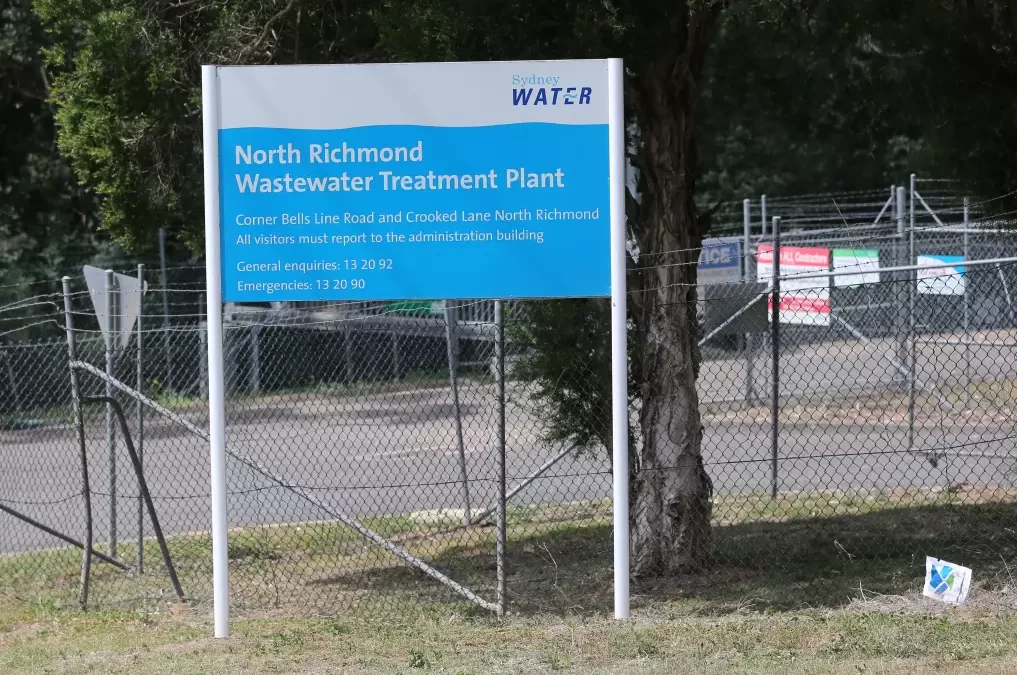
Following the revelation of high concentrations...
When the first of a series of major floods hit...

829 Upper Colo Road, Colo Perfectly...

11 Terrain Road, North Richmond Welcome to 11...
259 Pitt Town Bottoms Road, Pitt Town Bottoms...
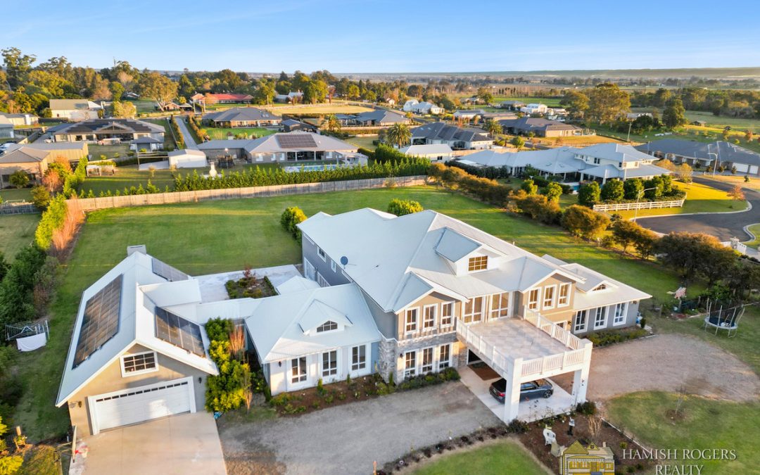
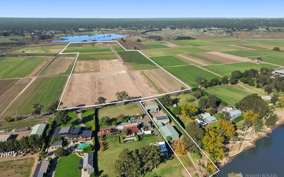
53 Hawkesbury Street, Pitt Town Hamish Rogers...
The Hawkesbury's own Courtney Nevin is set to...

At just 16 years old, Mikaela Shedden has...

With a dedication to equestrian sports which has...

In a spectacle that captivated a packed Stadium...

Huge crowds descended on Clarendon Showgrounds...

by Imogen Abbott Fantasia Showstoppers is...
On Sunday 2 June, Kurrajong Heights Bowling Club...

New Haven Farm Home is a local...